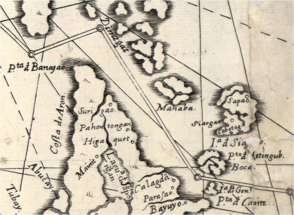
A hydrographic chart and corográfica of the Siargao Philippines
A hydrographic chart and corográfica of the Siargao Philippines
Fr. Pedro Murillo Velarde's Mapa de Filipinas, the first detailed map of the Philippines published in 1734.
SURIGAO
PAHONTUNGAN (Panhutongan)
HIGAQUET (gigaguet)
SIARGAO (Del Carmen)
MAHABA
CABOTOG (Gen. Luna)
SAPAO (Sta. Monica)
LAGUA SAPONGAN (LAke Mainit)

- Rate this item
- Published in HISTORY
- Read 5560 times

Latest from SurigaoIslands
- Angkol Sugar Car Rental | Hiace, Multicab, L300, Bongo & Sedan Rental in Mindanao
- Butuan City to Cagayan de Oro City Bus Schedule and Fare Guide
- Lt. Thomas Mosende Madelo: The Life Story of a Legendary Philippine Constabulary Crime Fighter
- Bachelor Express Bus Schedule and Fare Update: Davao City to Surigao, Tacloban, and Ormoc
- Updated Nasipit Port Vessel Schedule May 2026 | Cebu, Bohol & Manila Ferry Trips
Related items
- Lt. Thomas Mosende Madelo: The Life Story of a Legendary Philippine Constabulary Crime Fighter
- Remembering a Legacy: Coleto M. Garrido, Founding President of KASAMA
- Surigaonon: Preserving the Endangered Language of the Caraga Region
- The Lost Giant: The Sinking of IJN Fusō
- Resilience in the Face of Devastation: The Surigao del Norte Provincial Library After Typhoon Louise